
Argenton to Glendale shared pathway
Consultation has concluded
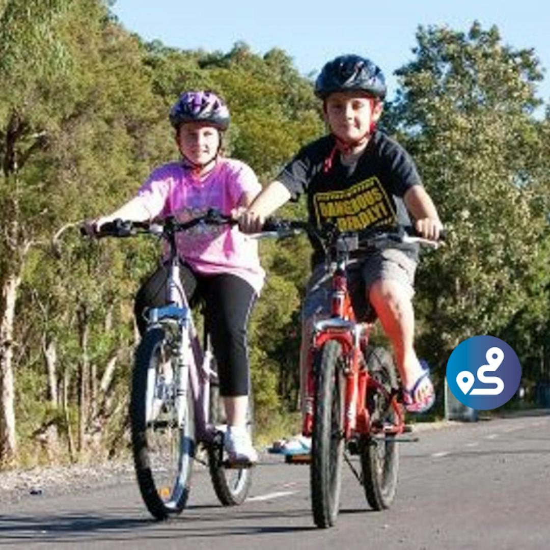
Planning for the next stage of the Speers Point to Glendale shared pathway is underway.
This stage of works will be constructed from Lake Road, Argenton, along the former tram corridor to Frederick Street, Glendale where it will join the existing shared pathway near the Glendale TAFE.
Council is currently finalising the planning approvals for the project. It is expected that the project will commence during the 2018/19 financial year and be completed during the 2019/2020 financial year.
Take a look at the frequently asked questions below, or post your own.
-
Share on Facebook Share on Twitter Share on Linkedin Email this link
Can I ask if Council are still investigating options for a shared pathway or cycleway along the Bareki Road bends at Eleebana to join Eleebana Lions Park to Thomas Halton Park? Thank you
RockyPointResident asked about 5 years agoHi there,
Thanks for the question. I can advise that Council has looked into the alignment of the shared pathway on Macquarie Drive to connect the existing pathway at Glad Gunston Drive, Eleebana to Thomas H Halton Park, which avoids the Bareki Road bends. Due to site constraints going over Macquarie Drive, at this stage no alignment has been finalised. Council will continue to investigate options to connect Eleebana and Croudace Bay, with this project listed as a medium to high priority in Council's Cycleway Strategy.
Regards,
Luke
-
Share on Facebook Share on Twitter Share on Linkedin Email this link
Your website says this project is due for completion by the end of 2018. I cycle to Cockle creek and don't see any construction between the station and Frederick St. Is this going to happen this year?? Peter Botha
Petergb asked over 5 years agoHi Peter,
Thanks for your enquiry regarding the Argenton to Glendale shared pathway project. Council is currently finalising the planning approvals and once obtained, it is expected that the project will commence during the 2018/19 financial year and be completed during the 2019/20 financial year.
Thanks for bringing the completion date error on the website to our attention. I have updated this to reflect the project timeline as advised by the Project Team.
Regards,
Luke
-
Share on Facebook Share on Twitter Share on Linkedin Email this link
Will there be increased access to the tramway track in the near future? At the moment there is only 3 entry points to the track- from the glendale and wallsend (2 entry points). This pathway is underutilised due to its restricted access. There could be other access points from resevoir road (for cardiff and east glendale residents) or croudace rd (for elermore vale residents). It really should have the patronage that the fernleigh track achieves.
Aaron asked over 6 years agoHi Aaron,
Thank you for your enquiry regarding shared pathway construction on Reservoir Road, Glendale and Croudace Road, Elmore Vale. Croudace Road is in Newcastle City Council (NCC) administrative area, and your enquiry regarding this section should be forward to NCC.
A review of the shared pathways works register indicates there are no sections of shared pathway listed for construction on Reservoir Road.
Projects currently underway for completion as a high priority include:
Speers Point to Glendale shared pathway
Fernleigh Track extension from Alick Street, Belmont to Belmont Golf Club
Belmont Golf Club to Blacksmiths shared pathway
Bareki bends link, Eleebana
In determining priorities for the installation of pathways across Lake Macquarie, Council has adopted its Cycling Strategy 2021. This strategy uses weighted criteria to assess the suitability of locations city wide for the installation of shared pathways. It also includes a works register for programming implementation in the highest priority locations.
The Lake Macquarie shared pathway network currently includes over 80km of off road and on road cycle ways. Through the adoption of the Lake Macquarie Cycling Strategy 2021, Council has outlined its long term commitment to the extension of the shared pathway network throughout Lake Macquarie. Through its annual budget, Council sets a target for the delivery of a minimum of 6km of new cycle ways.
In addition, Council is promoting increased uptake of active transport through the Lake Mac Walks project. As part of this project, Council is creating a methodology with assistance from the community to prioritise proposals such as these, so active transport connections continue to align with community aspirations.
Regards,
Luke
-
Share on Facebook Share on Twitter Share on Linkedin Email this link
Once the Walkway gets to the intersection of Frederick St & B89 will there be provision for users from the west to join into the walkway ? I'm not sure, but I doubt there would a footpath from that direction that would allow some users to use this walkway.
Wallyone asked over 6 years agoHi Wallyone,
Thanks for your question. I will follow up with the project team and get back to you with more information asap.
We are working through the preliminary planning phase, and considering a few different route options following community input earlier this year. As part of this, we will look at how the new link connects with existing footpaths in the area, and will consider this issue further as we progress.
-
Share on Facebook Share on Twitter Share on Linkedin Email this link
Why can't the pathway travel along Cockle Creek through the golf course or along the main road, rather than at the back of properties on Park Ave?
almost 7 years agoAs part of the early planning process, we considered a number of potential route options including the Crown land adjacent Cockle Creek. Unfortunately, this publically owned land ends approximately 350 metres south of Frederick Street, with the remaining length privately owned golf fairway. Due to the anticipated impact on business operations and planning implications, this option is considered unfeasible.
Due to the volume of traffic, number of driveways and access to the roundabout at Stockland Drive, it is not considered a safe or feasible option to route the shared pathway along Lake Road.
-
Share on Facebook Share on Twitter Share on Linkedin Email this link
Council want to take down our perfectly good metal fence to replace it with a timber fence with a height between 2.4 and 2.8m. Is this going to happen? Who will maintain it?
almost 7 years agoA 1.8 metre, lapped and capped timber fence is proposed to replace the existing boundary fence of properties located immediately adjacent the shared pathway on Park Avenue.
During initial discussions with residents, we heard that some would prefer to keep their existing fence while others would prefer a colourbond or metal fence. In response, Council has decided to offer a replacement fence to all affected residents, and only install those who choose to take up the offer. We are currently considering a preferred fencing option.
The replacement fence would be paid for, installed and maintained by Council.
-
Share on Facebook Share on Twitter Share on Linkedin Email this link
Security is an issue and there is concern that having high fences and no visibility out the back of properties on Park Ave will encourage anti-social behaviour.
almost 7 years agoWe appreciate your concerns for security and amenity, and we are considering this as we continue to work on the detailed planning. Our experience on other shared pathways across Lake Macquarie, has shown that people actively using these pathways provides passive surveillance that may not otherwise happen.
We are looking at ways we can minimise impacts on local residents, including blocking access along the drainage channel, offering secure fencing at 1.8 metres high as well as investigating other design and landscaping solutions.
-
Share on Facebook Share on Twitter Share on Linkedin Email this link
Who is going to maintain the track?
almost 7 years agoCouncil’s maintenance teams will be responsible for maintaining the track and immediate surrounds. A routine maintenance schedule will be developed, similar to the Fernleigh Track and other shared pathways across the City.
Glendale to Speers Point shared pathway route


Who's listening
-

Phone (02) 4921 0333 Email [email protected]
Life Cycle
-
Consultation with residents
Argenton to Glendale shared pathway has finished this stageWe are consulting with adjacent residents to inform the detailed plan and determine ways we can minimise impacts during construction and operation of the shared pathway.
-
Detailed planning
Argenton to Glendale shared pathway is currently at this stageCouncil is currently finalising the planning approvals required. It is expected the project will commence during the 2018/2019 financial year.
-
Construction underway
this is an upcoming stage for Argenton to Glendale shared pathwayIt is anticipated construction will commence early 2019.