Share Flood planning for LT Creek on FacebookShare Flood planning for LT Creek on TwitterShare Flood planning for LT Creek on LinkedinEmail Flood planning for LT Creek link
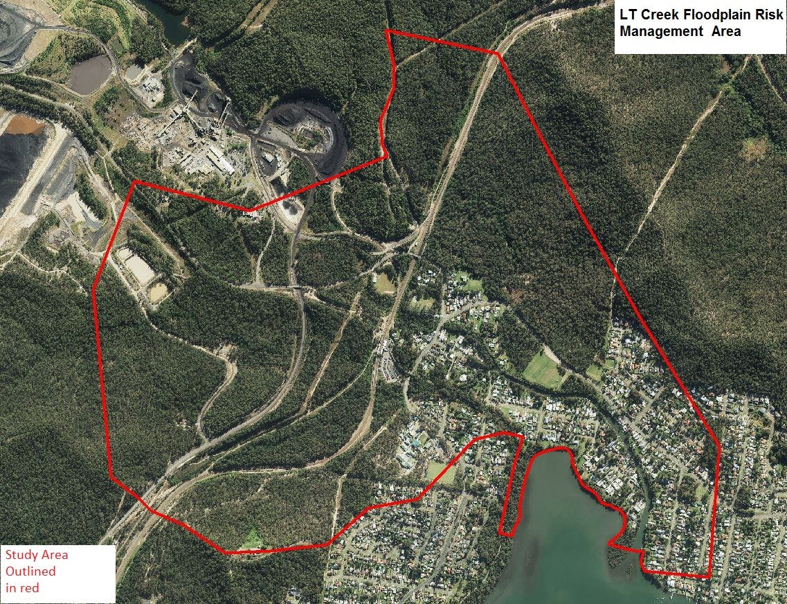
This Flood Study and Floodplain Risks Management Plan focuses on the floodplain risks at Fassifern and Fennell Bay and the surrounding area.
The Plan identifies and assesses the flood management options available, potential economic or ecological costs and potential impacts of flooding on local properties. Community input into this study helped to identify folding issues and evaluate possible management options.
It ranks the various available flood risk management measures and provides recommendations and a guide for completion.
Some of the high-priority measures include:
Developing flood awareness programs;
improving flood warnings;
reviewing access for properties during a flooding event;
applying floor level controls to reduce flood damages; and
assessing sewerage systems to ensure safety during a flooding event.
Council will take all submission responses into consideration when finalising the LT Creek Floodplain Risk Management Study and Plan.
Consultation has concluded
Share Exhibition submission form on FacebookShare Exhibition submission form on TwitterShare Exhibition submission form on LinkedinEmail Exhibition submission form link
Lake Macquarie City Council is
carrying out a floodplain risk management study for the L T Creek catchment at Fassifern.
The
purpose of the study is to identify the nature of flooding in the
catchment area to enable Council to better understand, plan and manage the
potential flood risk.
The information you supply will be used by staff at Lake Macquarie City Council and WMAwater only.
Consultation has concluded
Share Previous consultation - L T Creek Floodplain Risk Management Study on FacebookShare Previous consultation - L T Creek Floodplain Risk Management Study on TwitterShare Previous consultation - L T Creek Floodplain Risk Management Study on LinkedinEmail Previous consultation - L T Creek Floodplain Risk Management Study link
Flood planning for LT Creek has finished this stage
This consultation is Open for contributions.
Under Review
Flood planning for LT Creek has finished this stage
Contributions to this consultation are closed for evaluation and review. The Project team will report back on key outcomes.
On Exhibition
Flood planning for LT Creek has finished this stage
The draft report incorporating previous consultation outcomes is on public exhibition for review. This may include a summary of all contributions collected as well as recommendations for future action.
Council adopted the LT Creek Floodplain Risk Management Study and Plan.
Flood planning for LT Creek is currently at this stage
Council adopted the LT Creek Floodplain Risk Management Study and Plan on 23 April 2018.